
Welcome to WLMC :
The Google directions will get you there, but they may take you the scenic route! be aware.
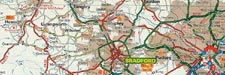
Varied terrain consisting of a wooded hillside with a small quarry area, stream, rocks, banks, gullies. From Leeds Ring Road A6110 at Farnley turn off at roundabout onto B6154, turn immediately left onto Wood Lane. Entrance is on your right. Note: - Practicing on this land is illegal. We have permission for organized events only. The area is patrolled by park rangers. Grid ref SE244 336. Click here for map.
Varied terrain at this venue, rocks mostly and lots of bracken, a shortish circuit, but with an open outlook.
Take the B6265 north out of Skipton, turn left onto Bog Lane approx 0.8 mile from A65 roundabout. Venue will be on your right.
Host to many big trials in the past including British rounds. Situated on a rock strewn hillside, rocks are the order of the day here, small ones to giant ones, but very grippy.
From the A65 turn off onto Cocking Lane, road name changes to Brown Bank Lane, turn left onto Light Bank Lane, venue will be on your left after approx 1 mile. Grid ref SE063 466. Click here for map.
A popular venue comprising of stream sections, rocks, bankings.
From the centre of Skipton head south on the A6131 for nearly a mile, turn left over canal bridge and bear right. Grid ref SD997 503. Click here for map.
A steep hillside with a stream running through it gives plenty of scope for sections at this venue, plus we have the use of the moorland above this area to give a good ride round for the bigger events. From the B6160 turn off onto minor road toward Arncliffe and Halton Gill , entrance will be on the right approx 6 miles from the B6160 junction. Note: - Practicing on this land is by arrangement with the landowner Mr B Wilkinson. Grid ref SD883 762 Click here for map.
From the A684 in Hawes take the minor road past the Wensleydale Creamery Visitor Centre, left over bridge then right through Gayle; continue up steep hill and where main road bends sharply to the left (approx 3.25 miles from Hawes) go straight on to Cam High Road (gated) for another 3 or 4 miles where you will arrive at the start area. Alternatively from the B6160 at Buckden take the minor road to Hubberholme through Yockenthwaite and Oughtershaw and turn left where road bends sharply to right onto Cam High Road. (Approx 8 mile from Buckden) Note: - Practicing on this land is illegal. We have permission from our Farmers/Landowners and various Government Agencies for organized events only. Grid ref SD812 817 Click here for map. For a detailed map of the Hawes area click here.